
The right handheld navigation tool can turn a foggy ridge traverse or a remote canyon route into a confident, well-managed outing. Solo trekkers, group leaders, and weekend overlanders all face the same core trade-off: how much weight and learning curve are you willing to carry in exchange for reliable location data and a way to reach help if things go sideways. This roundup breaks down ten solid options, from satellite messengers built for true off-grid safety to rugged handheld navigators for backcountry cartography and even magnetic asset trackers for vehicles and gear. You’ll find straightforward specs, real-world ownership context, and clear guidance on which fits your style of travel.
A Quick View Of The Lineup

Garmin inReach Mini 2 Satellite Communicator (Flame Red)
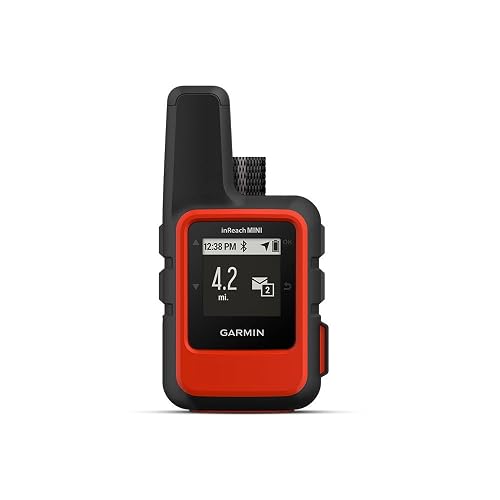
Garmin 010-01879-00 InReach Mini Satellite Communicator (Orange)
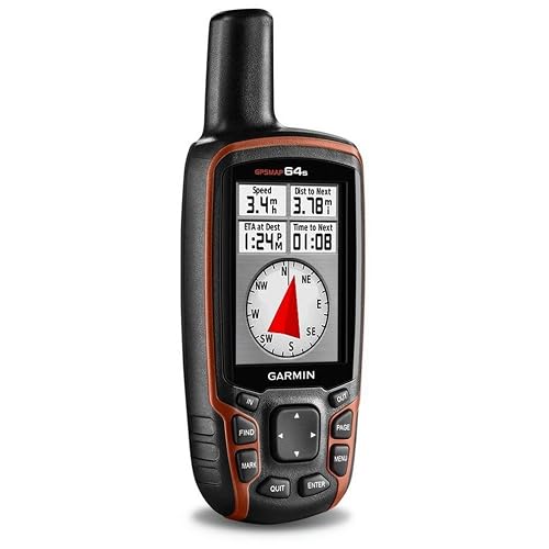
Garmin 010-01199-10 GPSMAP 64s Handheld GPS

Garmin GPSMAP 64st TOPO U.S. 100K Handheld GPS
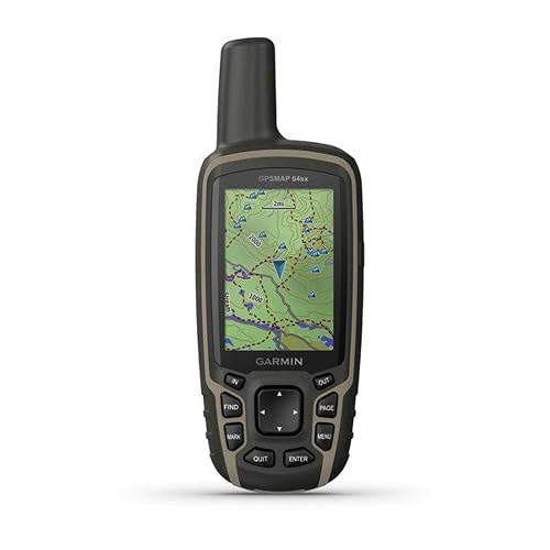
Garmin 010-02258-10 GPSMAP 64sx Handheld GPS
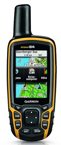
Garmin 010-01199-00 GPSMAP 64 Worldwide Handheld GPS

Garmin inReach Mini 2 Satellite Communicator (Orange)
LandAirSea 54 GPS Tracker Magnetic Waterproof
LandAirSea Overdrive GPS Tracker Extended Battery

LandAirSea Sync GPS Tracker OBD-II Plug
A Closer Look At Each Pick
The Mini 2 is the kind of tool solo hikers and bikepackers tend to forget they packed, until the moment a storm rolls in or a trail junction goes missing. It pairs global two-way text messaging over the Iridium satellite network with a dedicated SOS button that routes to a 24/7 emergency response center, so you carry a real communication channel rather than just a waypoint logger. At roughly credit-card dimensions, it slips into a chest pocket or shoulder-strap pouch without crowding your kit.
Compared to the Garmin 010-01879-00 InReach Mini reviewed below, this Flame Red bundle pairs the newer Mini 2 hardware with an extended protection plan, which softens long-term risk if you tend to be hard on gear. For thru-hikers tackling routes like the PCT or CDT, that’s a meaningful add because replacement costs add up fast over a multi-month trip.
Notable Upsides
- Two-way satellite text exchange, not just outbound SOS, so you can coordinate pickup or weather updates with someone off-grid.
- Compact form factor that won’t fight for space against a hydration bladder or trekking pole straps.
- TracBack routing lets you retrace a recorded track when cloud cover kills landmarks.
- Water-resistant build handles stream crossings and steady rain during shoulder-season travel.
- Bundled extended protection plan reduces exposure to repair and replacement costs.
Things To Consider
- An active satellite subscription is required, adding a recurring fee that should factor into your budget.
- The small screen demands deliberate typing, which gets awkward with cold fingers or bulky gloves.
Right Fit For
Solo backpackers and bikepackers who prioritize a dependable SOS and off-grid messaging link on multi-day trips where cell coverage vanishes.
Swap It Out When
Choose the Garmin GPSMAP 64sx instead if you need detailed on-device topographic maps for route-finding rather than primarily satellite communication.
Garmin’s original inReach Mini carved out the palm-sized satellite communicator category, and this orange version still earns a place in many packs. It rides the Iridium global satellite network for two-way text and emergency SOS, with a high-visibility shell that’s easier to spot if you set it down on a rock or drop it in the brush. Lightweight construction makes it feel almost weightless on a hip belt or shoulder strap.
The honest read is that newer Mini 2 hardware offers a brighter screen and better battery management, so this older generation feels more like a value-leaning choice than a tech-first pick. For weekend backpackers and international trekkers who want proven satellite reliability without chasing the very latest revision, it remains a sensible path.
Where It Excels
- Bluetooth pairing with your phone enables comfortable message composition through the Garmin Explore app.
- High-visibility orange shell helps when retrieving the unit from a pack pocket or finding it after a fall.
- Lightweight palm-sized profile keeps it from dominating your packing list on minimalist trips.
- Worldwide Iridium coverage works across continents, useful for cross-border trekking or remote expeditions.
Worth Noting
- Older generation compared to the Mini 2, with shorter battery endurance under frequent two-way messaging.
- An active satellite subscription is mandatory, and tier pricing can climb quickly with heavier message use.
- Limited onboard map detail, so it works best paired with a dedicated handheld GPS for navigation.
Made For
Backpackers and international travelers who want a reliable global SOS link at a more accessible price point than the newest Mini 2.
Consider Something Else When
Reach for the Garmin inReach Mini 2 in Flame Red instead if you want newer hardware with stronger battery life and bundled protection.
The GPSMAP 64s is the platform that built Garmin’s reputation for serious backcountry navigation. Its 2.6-inch sunlight-readable color screen keeps maps and waypoints legible at high noon on exposed ridges, and the combination of GPS plus GLONASS satellite support holds a fix in tree canopy and narrow canyons where phones tend to wander. Wireless connectivity and ANT+ sensor pairing open up heart rate, temperature, and cadence integration for moving fast.
Stepping up from the basic GPSMAP 64 reviewed below, the 64s adds wireless sharing, sensor support, and a richer accessory ecosystem, which is why it has stayed relevant for hunters and serious trekkers. For a multi-day Sierra traverse or a dense Appalachian hike, that connectivity and barometric altimeter support can matter more than raw screen size.
Real-World Strengths
- Dual GPS plus GLONASS reception maintains accuracy under thick tree cover and steep terrain.
- 2.6-inch sunlight-readable color display holds up against glare better than phones or smaller units.
- ANT+ sensor support pairs with heart rate straps, temperature sensors, and VIRB action cameras.
- 3-axis electronic compass and barometric altimeter aid navigation when standing still or tracking weather shifts.
Trade Offs
- Button-driven interface has a learning curve compared to touchscreen handheld GPS units.
- No two-way satellite messaging built in, so it pairs well with a separate communicator for off-grid safety.
Key Product Details
Best Suited To
Backpackers, hunters, and search-and-rescue volunteers who want a serious navigation tool with sensor expansion and reliable satellite reception.
A Better Fit Elsewhere
The Garmin GPSMAP 64st makes more sense if you want preloaded U.S. topographic maps and more internal storage for offline cartography.
The 64st is the workhorse of the GPSMAP family for North American hiking, because it ships with TOPO U.S. 100K maps preloaded on its 8 GB of internal memory. That means you can navigate trails, contour lines, and named peaks straight out of the box without buying additional cartography, which is a real convenience for backpackers who just want to grab the unit and go. Its 2.6-inch color screen is the same dependable, sunlight-readable panel found across the lineup.
Where it pulls ahead of the GPSMAP 64s reviewed above is bundled U.S. mapping rather than feature count, while the dual battery system supports both AA cells and a rechargeable NiMH pack. For long-distance section hikers and climbers working routes where topographic detail matters, that preloaded cartography is often the deciding factor.
A Few Highlights
- Preloaded TOPO U.S. 100K maps reduce setup time for trips entirely within the lower 48.
- 8 GB of internal storage plus microSD expansion accommodates additional regional maps.
- 16-hour battery life in typical use supports full-day trekking without mid-trip swaps.
- IPX7 water rating tolerates stream crossings and brief immersion in shallow water.
Points To Note
- Preloaded U.S. cartography is less useful for international trekking compared to global basemap options.
- Resolution sits at 160 x 240 pixels, which looks a touch dated next to newer touchscreen handhelds.
- Carrying spare AAs adds bulk for ultralight hikers counting every gram in their pack.
Perfect Match For
Backpackers and climbers tackling U.S. routes who want topo detail on the device the moment they turn it on, without extra map purchases.
Where Another Pick Suits Better
Pick the Garmin GPSMAP 64sx if you want newer multi-GNSS support and updated TopoActive maps for international or mixed-terrain travel.
The GPSMAP 64sx is where the GPSMAP line gets a meaningful refresh, layering multi-GNSS support on top of the familiar 64-series hardware. By tapping multiple satellite constellations rather than just GPS and GLONASS, it improves fix times and accuracy in tricky environments where signal reflection and obstruction are common. The preloaded TopoActive maps give you a current view of trails and terrain without extra setup.
Compared to the 64st above, this unit trades some legacy mapping for newer multi-constellation accuracy and updated cartography, which matters for technical canyon routes. For hikers and climbers moving through mixed terrain, the altimeter and three-axis compass keep orientation reliable even when standing still at a junction.
The Case For It
- Multi-GNSS support delivers faster, more consistent satellite fixes in obstructed terrain.
- TopoActive maps provide current trail data without requiring additional purchases.
- Button-based interface remains glove-friendly in cold-weather or wet conditions.
- Rugged, water-resistant shell handles bumps, dust, and light rain across long trips.
Minor Gripes
- Small screen and button layout slow down fast map browsing compared to touchscreen alternatives.
- No two-way satellite communicator, so it pairs naturally with an inReach for full safety coverage.
Feature Snapshot
Who Should Grab It
Hikers and climbers who want modern multi-constellation accuracy and updated trail mapping in a familiar rugged handheld form factor.
Not Your Match When
Reach for the Garmin GPSMAP 64st instead if your routes stay within the U.S. and you’d prefer the older TOPO U.S. 100K dataset with bigger internal storage.
The base GPSMAP 64 keeps the same dependable receiver and 2.6-inch sunlight-readable display that defined this product line, dropping wireless and barometric extras to land at a friendlier price. Its worldwide basemap is enough for general orientation in unfamiliar terrain, with the option to load detailed regional maps as your ambitions grow. For someone moving up from phone-only navigation, it provides a tangible jump in reliability.
Think of it as the entry point into the GPSMAP family, sitting below the 64s reviewed above and the 64sx covered further down. You give up Bluetooth sharing and ANT+ sensor pairing, but you keep the rugged hardware that makes this series a long-time favorite.
Useful Strengths
- Quad helix antenna delivers reliable reception in canopy and canyon environments.
- Worldwide basemap provides general context without forcing immediate map purchases.
- Rugged, water-resistant housing handles drops, scrapes, and wet weather in the field.
- AA battery compatibility makes field swaps easy on extended trips.
Softer Spots
- Lacks Bluetooth and ANT+ support found on higher-tier siblings like the 64s.
- No barometric altimeter, so elevation tracking depends on GPS-derived data.
- Add-on regional maps can climb in cost as your trip range expands.
Quick Facts
Who It Suits Best
First-time handheld GPS users and weekend hikers stepping up from smartphone navigation who want rugged hardware without paying for wireless extras.
Reach For A Different Pick When
Pick the Garmin GPSMAP 64s if you want Bluetooth sharing and ANT+ sensor support for fitness and accessory integration.
The Mini 2 in orange brings the same compact satellite communication platform as the Flame Red bundle reviewed above, in a high-visibility shell that pops against dark packs and forest floor debris. Two-way global messaging, interactive SOS, and TracBack routing are all on board, making it a strong fit for long routes through cell-dead zones. The water-resistant build shrugs off rain and stream spray without drama.
For ultralight backpackers and thru-hikers packing for months on end, this unit delivers the same core capability as the bundle version in a body that disappears in a chest pouch. Just remember an active satellite subscription is mandatory to send or receive messages, and that subscription cost is the actual ongoing commitment rather than the device itself.
Advantages To Know
- Two-way satellite text and interactive SOS over the Iridium network across continents.
- TracBack routing lets you retrace a path when visibility drops or landmarks repeat.
- Compact, lightweight chassis fits comfortably on a pack strap or jacket pocket.
- Bluetooth pairing routes message typing through your phone for a less fiddly interface.
Some Limits To Know
- Subscription is required for any satellite feature, so budget accordingly for ongoing fees.
- Mini screen limits standalone map detail, which is why most owners pair it with a phone.
- Some jurisdictions restrict satellite communication devices, so check local rules before international travel.
Whose Shelf It Belongs On
Thru-hikers and international backpackers who want proven global SOS and lightweight communication without hauling a full handheld GPS.
Look Elsewhere When
Reach for the Garmin GPSMAP 64sx if detailed topographic mapping for route-finding matters more than satellite text messaging on your trips.
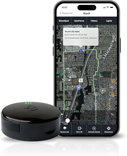
The LandAirSea 54 shifts the GPS conversation away from hiking trails and toward vehicle and asset tracking. Its strong internal magnet sticks to steel frames on trailers, ATVs, and golf carts, while a waterproof shell stands up to rain, snow, and the occasional puddle splash. Real-time location updates through the SilverCloud app or web portal let you watch movement on Google Maps as it happens.
Location updates as fast as every three seconds give you a near-continuous breadcrumb trail, and historical playback covers up to a year of stored movement data. For trail users, this isn’t a navigation tool, but it earns its place for people safeguarding gear that gets parked at remote trailheads.
What Works In Its Favor
- Built-in magnet simplifies attachment to vehicles and equipment without extra mounting hardware.
- Waterproof housing keeps the unit working through wet weather and stream splashes.
- Real-time tracking with up to one year of historical playback for movement review.
- Geofencing alerts notify you when an asset enters or leaves a defined zone.
Areas To Watch
- A subscription is required, and monthly fees add up over multi-year ownership.
- Magnetic attachment depends on a steel surface, so it won’t cling to aluminum trailers or plastic enclosures.
Built With In Mind
Owners of trailers, work trucks, ATVs, and recreational vehicles who want a covert, magnet-mounted tracking solution for asset security.
Where A Sibling Pick Shines
The LandAirSea Overdrive is a better match when longer intervals between charges matter more than the compact form factor.
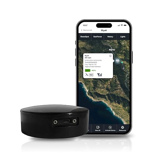
The Overdrive is the work-focused sibling in the LandAirSea line, built for longer deployments where recharging isn’t convenient. Its extended-life battery keeps location reporting going across longer windows, while the same magnetic, waterproof construction makes installation a matter of sticking it to a metal surface. It’s marketed toward commercial fleets, trailers, and equipment assets that move less often but need reliable oversight.
Tracking works across more than 155 countries, which matters for operations that cross borders or move equipment between distant sites. For trail users, the practical application is gear you park for days at a time, like a basecamp trailer or a remote work truck.
Well-Handled Touches
- Extended-life battery supports longer deployments between charges.
- International tracking coverage across 155-plus countries for cross-border operations.
- Waterproof and magnetic design simplifies installation on trucks, trailers, and equipment.
- Real-time alerts and geofencing help monitor movement and boundary crossings.
Honest Caveats
- Subscription required, with fees scaling depending on update frequency and service tier.
- Larger form factor than the compact LandAirSea 54 above, so placement discretion may be harder.
Who Will Love This
Fleet managers and property owners overseeing vehicles, trailers, and equipment that sit idle for stretches but need dependable remote oversight.
Skip It When
The LandAirSea 54 makes more sense if you want a smaller, more discreet tracker for short-term vehicle placements at trailheads.
The Sync trades magnets and batteries for a direct plug into a vehicle’s OBD-II port, the diagnostic connector standard on most cars and light trucks built after the mid-1990s. That setup draws continuous power from the vehicle, so you never need to charge the unit or worry about it falling off a chassis mid-drive. Real-time 4G LTE tracking updates through the SilverCloud app keep you informed on every move.
Compared to the magnetic LandAirSea 54 above, this approach is less covert but much more permanent, which suits parents tracking teen drivers or small-business owners keeping tabs on a fleet. Out of sight, out of mind describes the design philosophy, since the unit disappears beneath the dash once installed.
Strengths Worth Knowing
- OBD-II plug-in installation requires no tools or mounting accessories.
- Continuous vehicle power keeps the tracker running without manual charging.
- 4G LTE real-time updates provide near-instant location visibility on Google Maps.
- Historical playback covers up to a year of stored route data for review and reporting.
Less-Strong Areas
- Requires a compatible OBD-II port, so it won’t fit motorcycles, trailers, or older vehicles.
- Monthly subscription cost is a recurring commitment on top of the hardware.
Feature Overview
Who It Suits Best
Personal vehicle owners and small fleet operators who want set-and-forget tracking without dealing with batteries or mounting hardware.
Where It Is Less Suited
Pick the LandAirSea Overdrive instead for non-OBD applications like trailers, ATVs, or construction equipment without diagnostic ports.
What Actually Matters In A Hiking Gps Device
Map Detail Versus Satellite Communication
Handheld GPS units like the GPSMAP 64sx store detailed topographic maps on-device, which means you see contour lines and named trails even with your phone buried in airplane mode. Satellite communicators like the inReach Mini 2 don’t replace maps; they add an off-grid messaging layer that complements a phone or dedicated navigator. Think of maps as your route-finding tool and satellite messaging as your safety net.
Most experienced backpackers carry both categories in some form, because the jobs they do are different. A handheld GPS keeps you oriented through fog and featureless terrain, while an inReach-style device gets help to you when injury or weather forces a change in plans.
GNSS, Reception, And Battery Life
GNSS, or Global Navigation Satellite System, is the umbrella term for the satellite constellations that feed position data to your device. Older units lock onto GPS alone, while newer models add GLONASS, Galileo, or other constellations to improve accuracy under canopy. Battery life varies widely, with the GPSMAP 64 line rated around 16 hours of typical use and satellite communicators often running shorter between charges depending on message frequency.
For multi-day trips, AA battery compatibility offers a safety margin you don’t get with sealed rechargeable units, since you can pack spares. For weekend trips with easy access to outlets, built-in rechargeable batteries keep the hardware lighter and simpler.
Subscriptions And Ongoing Costs
Satellite communicators and real-time GPS trackers almost always require a subscription to function, which is a cost worth understanding before purchase. Plans range from limited annual tiers for occasional hikers to higher monthly fees for frequent text messaging or continuous tracking. Hardware price is the entry ticket, but subscription tier is the real long-term number.
If you only need navigation on marked trails, a non-communicating handheld GPS has no recurring cost. If you want SOS and off-grid messaging, plan a budget line for the satellite service alongside the device itself.
Key Considerations Across These Picks
Where Shoppers Go Wrong
Choosing a satellite communicator and expecting it to replace a handheld GPS is a common mix-up. These tools do different jobs, and treating one as a substitute for the other can leave you stranded with a dead battery and no maps. Carry the navigation tool that matches your terrain, and consider adding a communicator if your routes involve real off-grid exposure.
Another trap is overlooking subscription requirements on satellite and tracker devices. Hardware looks comparable in price to a handheld GPS, but ongoing service fees can quietly double the cost of ownership over a few years.
When Paying More Pays Off
Stepping up to higher-tier Garmin handhelds typically buys more satellite constellations, better preloaded maps, and wireless sensor support. For technical routes with thin margins for error, those additions matter more than they would on a familiar local loop. The honest read is that the upgrade pays off when your trips get longer or more remote, and matters less for casual day hiking.
Frequently Asked Questions
Do Hiking Gps Devices Work Without Cell Service?
Yes. Handheld GPS units receive signals directly from navigation satellites, so they function in cell-dead zones the same way they do in town. Satellite communicators rely on Iridium or similar networks, which operate independently of cellular towers.
How Accurate Are Consumer Handheld Gps Units?
Most modern handheld units land within roughly 10 to 15 feet under open sky, and multi-GNSS models can do better. Accuracy degrades under dense canopy, in narrow canyons, or near tall cliffs where satellite signals bounce or block.
Can I Use My Phone Instead Of A Dedicated Gps?
Phones handle casual trail navigation well, especially with downloaded offline maps, but their GPS antennas and batteries are weaker than dedicated units. For multi-day trips or technical terrain, a handheld GPS adds reliability that a phone alone may not match.
Do Satellite Communicators Require A Subscription?
Yes, an active satellite subscription is mandatory for any inReach-style device to send or receive messages. Plans vary from annual low-use tiers to monthly higher-frequency options depending on how often you travel off-grid.
Are Gps Trackers Useful For Hiking?
Asset trackers like the LandAirSea line are designed for vehicles and gear rather than personal hiking use. They’re a smart choice for tracking a vehicle left at a remote trailhead, not for navigating trails in the field.
Bottom Line
Your best pick comes down to what you actually need on the trail. Backpackers prioritizing safety in true off-grid terrain will lean toward the inReach Mini 2 options for SOS coverage, while those who want detailed route-finding should focus on the GPSMAP handhelds. Asset trackers earn their place for vehicle and equipment security, but they aren’t hiking tools. Match the device to your route difficulty and the kind of help you want standing by, and you’ll end up with gear that earns its pack weight every trip.