
Cell signal drops off fast once you pass the trailhead, and most phones turn into expensive paperweights in the backcountry. The right satellite device keeps you oriented on remote routes, lets you ping loved ones when you’re out past dusk, and opens a critical line to rescue services if things go sideways. This roundup walks through ten solid options, from dedicated two-way messengers to GPS trackers built for vehicles and gear, so you can match the tool to the way you actually hike.
The Leading Options At A Glance

ACR ResQFlare Electronic Distress E-Flare and Flag (ACR 3966)
ACR ResQFlare E-Flare Safety Kit (Marine Safety Flare)
ResQLink View GPS PLB & ResQFlare Premium Safety Kit
Garmin inReach Mini 2 Satellite Communicator (Flame Red) Bundle
Garmin inReach Mini 3 Plus Satellite Communicator Bundle
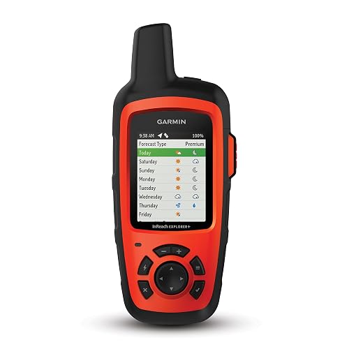
Garmin inReach Explorer+ Handheld Satellite Communicator

Garmin Foretrex 601 Wrist-Mounted GPS Navigator
LandAirSea 54 GPS Tracker (Magnetic, Waterproof)
LandAirSea Overdrive GPS Tracker (Extended Battery)

LandAirSea Sync GPS Tracker (OBD-II Plug-In)
A Breakdown Of The Leading Choices
The ACR ResQFlare is less of a GPS unit and more of a visual distress signal that earns a regulatory stamp most backcountry hikers will appreciate. Pair it with the bundled distress flag and you can satisfy U.S. Coast Guard nighttime visual distress signal requirements without carrying pyrotechnic flares. For kayakers, paddleboarders, and coastal campers who also log shoreline miles, that legal weight matters.
It floats, rights itself, and pushes light out 360 degrees with an IP67 waterproof rating. Owners commonly report tossing it in a dry bag pocket and forgetting about it until it matters.
Reasons It Performs
- Certified under USCG 161.013 as a nighttime visual distress signal when paired with the flag
- Self-righting, buoyant design prevents loss overboard in surf
- Compact enough to stash in a PFD pocket without crowding
- No expiration headaches like chemical flares
Trade Offs
- No navigation or messaging capability on its own
- Coastal regulation only applies inside U.S. waters
- Runtime is shorter than a dedicated beacon
Right Fit For
Boaters and paddlers who need a regulatory distress signal and a backup light for nighttime shoreline trips.
Consider Something Else When
Backcountry hikers who want two-way messaging should reach for the Garmin inReach Mini 3 Plus Bundle instead.
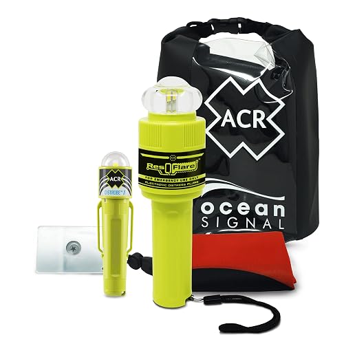
The ResQFlare E-Flare Safety Kit upgrades the standalone flare with the runtime, daytime flag, and accessories boaters actually want in one box. It covers both daytime and nighttime USCG signal requirements, which means you can leave the chemical flares at home for good. For anyone running offshore or coastal routes, that simplifies compliance dramatically.
The headline number is the 20-hour operational life, which runs more than three times the USCG minimum for peak intensity (75 cd). For most skippers, that’s enough margin to ride out a long search-and-rescue window.
Where It Excels
- 20-hour runtime beats the regulatory baseline by a wide margin
- Covers both daytime and nighttime USCG distress signal rules
- IP67 waterproof and self-righting for rough conditions
- Compact enough to mount near the helm
Honest Caveats
- Battery is sealed, so charging routine matters for long trips
- No navigation or satellite messaging built in
- Regulatory standing is U.S. only
Best Suited To
Recreational boaters who want a single kit to satisfy USCG day and night signaling rules.
A Better Fit Elsewhere
Hikers carrying packs into remote terrain get more value from the ResQLink View & ResQFlare Premium Kit, which adds a personal locator beacon.
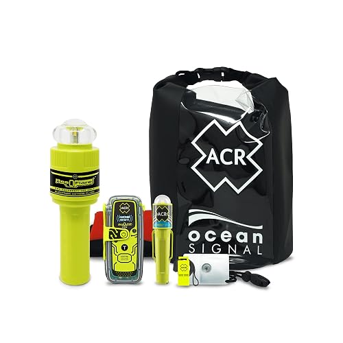
The ResQLink View and ResQFlare bundle pulls together a personal locator beacon (PLB), an electronic flare, and a stack of accessories into one ready-to-go kit. A PLB is a one-way satellite SOS transmitter that pings search-and-rescue directly without needing a subscription. For multi-sport users who split their time between mountains, lakes, and trails, that mix of capabilities covers more scenarios than any single device.
The kit also throws in a C-Strobe H2O rescue light, signal mirror, USCG whistle, RapidDitch dry bag, and daytime distress flag. It’s the kind of grab-and-go bundle that gets you on the trail or water without shopping for add-ons.
A Favorable Mix
- PLB sends an SOS without a monthly subscription
- Electronic flare and visual signal tools included
- Dry bag simplifies stashing gear on boats
- Covers both hiking and boating use cases
Points To Consider
- Bundled weight runs heavier than a single communicator
- PLB is one-way, so no check-in messages to family
- Longer learning curve to use every piece effectively
Who It Suits Best
Outdoor enthusiasts who hunt, hike, and boat across different terrain and want one kit instead of three.
Reach For A Different Pick When
Fastpackers prioritizing light packs should grab the Garmin inReach Mini 2 Bundle for two-way messaging at lower weight.
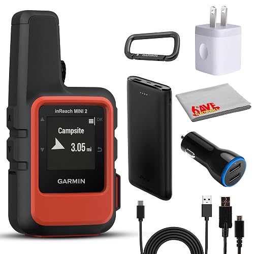
The inReach Mini 2 stays a favorite among weight-conscious hikers because it crams two-way satellite messaging into a package roughly the size of a deck of cards. The Flame Red bundle adds a 10-foot USB-A to USB-C cable, charging adapters, a car charger, and a portable battery so you can keep the device topped off on road trips and long approaches. Interactive SOS routes emergencies to the Garmin Response coordination center, which runs around the clock.
It pairs with Garmin’s Explore app for trip planning, tracking, and message composition on your phone, which makes the tiny on-device keyboard less of a chore.
The Helpful Details
- Two-way text messaging over the Iridium network
- Compact form factor for ultralight packs
- Bundle accessories cut the need for separate charging kit
- 24/7 SOS routing through Garmin Response
Softer Spots
- Active satellite subscription required
- Small screen makes long messages tedious
- No photo or voice support like the Mini 3 Plus
Built With In Mind
Solo hikers and ultralight backpackers who want two-way communication without adding serious weight.
Swap It Out When
Photographers and trip leaders who want to share images from the trail should upgrade to the Garmin inReach Mini 3 Plus Bundle.
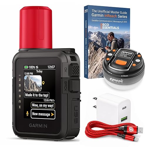
The Mini 3 Plus is the most capable pocket communicator Garmin currently ships, and the Deco bundle sweetens it with a braided 6-foot Type-C cable, charger, dome lantern flashlight, and a printed master guide. You get two-way text messaging, voice notes, location pings, and even photo sharing over the global Iridium satellite network. For long-haul trekkers who want richer check-ins than plain SMS, that mix of formats stands out.
An interactive SOS still routes to Garmin Response for round-the-clock coordination, and the rugged housing shrugs off rain and trail drops.
Strong Points
- Photo and voice message support beyond plain SMS
- Deco bundle adds charging and a camp lantern
- Rugged build suited to multi-day exposure
- Pairs with phone apps for easier message composition
Points To Keep In Mind
- Subscription fees apply for the satellite network
- Photo sharing uses more battery and bandwidth than text
- Higher tier commands a premium over the Mini 2
Whose Shelf It Belongs On
Multi-day backcountry trekkers and trip leaders who want richer communication options from the field.
Where A Sibling Pick Shines
Route-finding purists who want on-device topo maps should pick the Garmin inReach Explorer+ for its dedicated navigation screen.
The Explorer+ earns its slot by pairing two-way satellite messaging with preloaded topographic maps and onboard GPS navigation. A topo map is a terrain map showing contour lines, trails, and elevation, and having it on the device means one less reason to pull out your phone. The Iridium satellite coverage is global, so the Explorer+ works whether you’re in the Sierras or the Karakoram.
It runs on the same satellite subscription model as the Mini line, but the larger screen and physical buttons make navigation easier in cold or gloved hands.
What Stands Out
- Built-in topo maps reduce phone dependency
- Global Iridium coverage for international trips
- Larger screen eases map reading on the trail
- Physical buttons work with gloves
Worth Bearing In Mind
- Heavier than the Mini series for ultralight packs
- Subscription required to activate satellite features
- No photo or voice messaging like the Mini 3 Plus
Who Should Grab It
Route-finding hikers who want standalone navigation and satellite messaging in one unit.
Skip It When
Runners seeking a wrist-mounted alternative will find the Garmin Foretrex 601 a more natural fit.
The Foretrex 601 trades two-way messaging for hands-free navigation, which is exactly the trade-off trail runners and tactical hikers want. Built to MIL-STD-810G, it shrugs off temperature, shock, and water exposure. The 2-inch display reads cleanly at a glance, and night vision goggle compatibility makes it a favorite for users operating after dark.
It tracks GPS, GLONASS, and Galileo satellites simultaneously for sharper positioning, and a 3-axis accelerometer, compass, and barometric altimeter add navigation context. Battery life stretches past 48 hours in navigation mode.
Practical Advantages
- Hands-free wrist mount keeps your hands on trekking poles
- Multi-constellation satellite tracking improves accuracy
- 48+ hour battery in navigation mode
- Night vision compatible for low-light operations
Potential Drawbacks
- No satellite messaging or SOS button
- Smaller display than handheld mapping units
- Bluetooth smart notifications depend on phone pairing
Made For
Trail runners, land navigators, and tactical users who prioritize navigation over messaging.
Not Your Match When
Hikers who need to call for help via satellite should pair the Foretrex with the Garmin inReach Mini 2 Bundle instead.
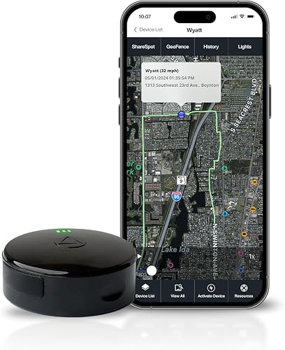
The LandAirSea 54 shifts the conversation away from personal safety toward tracking gear, vehicles, and trailers. A built-in magnet snaps it onto metal surfaces, so you can hide it under a truck or strap it to an ATV frame in seconds. Real-time location updates flow through the SilverCloud app or web portal, with refresh intervals as tight as three seconds.
It’s made in the USA from a mix of domestic and imported parts, and the waterproof housing handles rain and stream crossings without complaint. Historical playback keeps up to a year of route data.
Advantages To Know
- Magnetic mount installs in seconds on metal
- Three-second refresh for near-real-time tracking
- Up to one year of historical playback
- Waterproof housing for outdoor deployment
What To Weigh
- Subscription required to keep data flowing
- Not designed as a personal SOS device
- Battery life depends heavily on update frequency
Perfect Match For
Vehicle owners, hunters, and trail-equipment managers who need ongoing location history on high-value gear.
Look Elsewhere When
Hikers wanting personal safety should pick the Garmin inReach Mini 3 Plus Bundle for SOS capability.
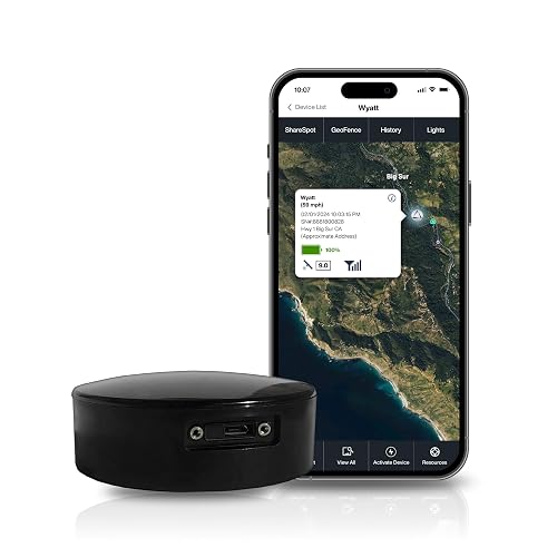
The Overdrive takes everything the LandAirSea 54 does and stretches the battery life for longer deployments. International tracking works in over 155 countries, so fleets that cross borders or contractors who move between job sites stay visible. The same magnetic, waterproof shell sticks to trucks, trailers, and construction equipment without special mounts.
Real-time alerts and geofencing mean you can set virtual boundaries around a job site and get pinged the moment a vehicle crosses them.
Real-World Strengths
- Extended battery reduces recharging downtime
- Geofencing alerts flag unexpected movement
- Works in over 155 countries for cross-border fleets
- Magnetic mount installs without tools
Possible Compromises
- Monthly subscription adds to total ownership cost
- Higher update rates drain battery faster
- Not a substitute for a personal SOS device
The Right Fit
Commercial fleet managers and equipment owners who want long intervals between charges.
Where Another Pick Suits Better
Casual car owners looking for a set-and-forget tracker will find the LandAirSea Sync more convenient.
The Sync plugs directly into a vehicle’s OBD-II port, which is the standardized diagnostic socket found in cars and light trucks built after 1996. That single design choice turns installation into a five-second task: locate the port, click the tracker in, and drive. There’s no magnetic mount to deal with and no battery to charge, since the unit pulls power from the car itself.
It still streams 4G LTE real-time tracking through the SilverCloud app and supports geofencing and one year of playback history. For households managing teen drivers or small delivery fleets, that simplicity is the main attraction.
Well-Handled Touches
- OBD-II plug-in design eliminates charging
- 4G LTE updates every three seconds
- Geofencing alerts on boundary crossings
- Compact enough to stay hidden under the dash
Things To Weigh Up
- Tied to vehicles with OBD-II ports only
- Subscription fees apply for ongoing tracking
- Won’t help hikers outside the vehicle
Who Will Love This
Families and small fleet operators who want zero-install, always-on tracking on their daily drivers.
Another Choice May Suit
Backcountry travelers who want portable GPS should look at the Garmin inReach Mini 2 Bundle for hand-held communication.
What To Weigh Before Choosing Your Satellite Companion
Picking the right satellite GPS for hiking depends more on how you hike than on any single spec sheet. Solo trekkers who disappear into the backcountry for days usually need two-way text messaging and an interactive SOS that routes to a real coordination center, which is exactly where the Garmin inReach Mini 3 Plus and Mini 2 shine. Hikers who stick to day trips on well-marked trails may get away with a phone and a download of offline maps, though a PLB like the ResQLink View still earns its keep if the worst happens.
Battery life shapes the experience more than most shoppers expect. Devices that stream frequent location pings drain faster than units set to longer intervals, so matching the update interval to your trip length avoids mid-trail shutdowns. Subscription plans also vary widely in coverage and flexibility, and understanding whether you’re paying for global Iridium access or a regional LTE tracker avoids surprises after you buy.
Weight and form factor matter once you start counting grams. Wrist-mounted units like the Foretrex 601 trade messaging for always-visible navigation, which trail runners love and backpackers sometimes miss. Vehicle and asset trackers serve a completely different use case, so be honest about whether you’re tracking yourself, your car, or your trailer before choosing.
Key Considerations Across These Picks
Pitfalls Shoppers Hit
A common mistake is buying a satellite tracker expecting it to work like a phone, only to discover that most PLBs and trackers are one-way. Two-way messaging requires a subscription-based communicator like the Garmin inReach line, while one-way devices still summon help but can’t confirm your status to family. Choosing the wrong category leaves you with a tool that doesn’t fit how you actually hike.
Another trap is overlooking subscription costs. Satellite communicators and most GPS trackers carry monthly fees that vary by plan tier, and those fees compound over years of ownership. Budget the recurring cost alongside the hardware price to avoid sticker shock after the first billing cycle.
What The Higher Tier Buys
Stepping up to a premium communicator like the inReach Mini 3 Plus buys richer communication formats, including photo and voice messaging, plus a more rugged build. For multi-day treks and group leaders, that richer communication can shorten rescue response times and reassure worried families. The extra money mostly funds satellite bandwidth and tougher hardware, which pays off most on long, high-stakes trips.