
Whether you’re laying out fence corners on a back forty, keeping tabs on a trailer parked at a remote job site, or carrying two-way satellite text into a slot canyon, the right GPS handheld shapes the whole day. The category splits pretty hard into two camps: surveyor-grade RTK rovers for centimeter accuracy, and rugged communicators or asset trackers for keeping people and property accounted for. This list pulls from both sides so you can match the tool to the work.
The Shortlist At A Glance
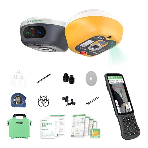
L1-AR GNSS RTK Base+Rover GPS Handheld Collector

Dakota Digital GPS Interface Speed Sensor GPS-50-2
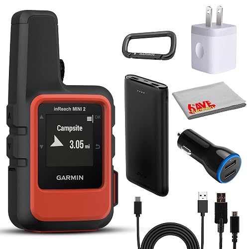
Garmin inReach Mini 2 Satellite Communicator Bundle (Flame Red)
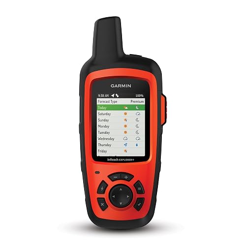
Garmin inReach Explorer+ Handheld Satellite Communicator
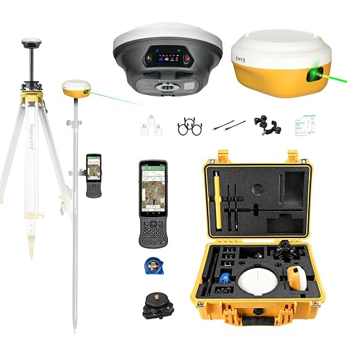
E1 Pro-L1 Laser GPS Rover RTK & Base Station GNSS Survey System

E1 Lite GNSS RTK Surveying Equipment RTK GPS Handheld Collector
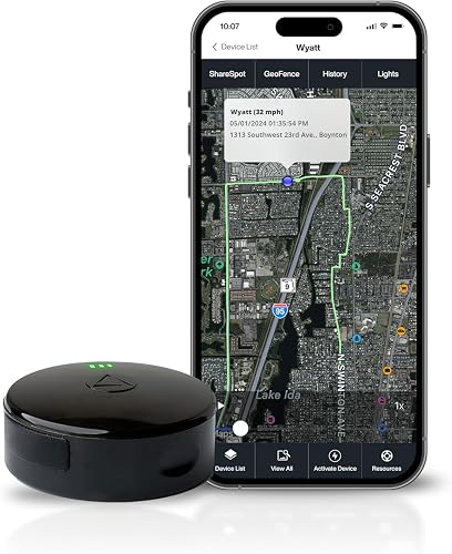
LandAirSea 54 GPS Tracker Magnetic Waterproof Global
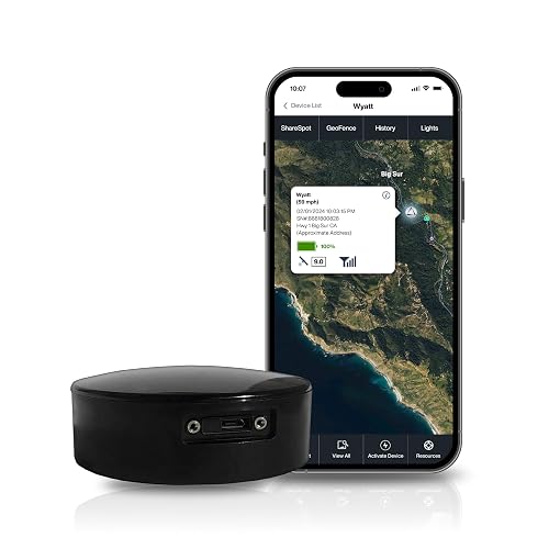
LandAirSea Overdrive GPS Tracker Extended Battery Magnetic

LandAirSea Sync GPS Tracker 4G LTE OBD-II
More Details On Our Top Picks
The L1-AR pairs a 1408-channel L1/L2 GNSS engine (the chip that listens to satellite constellations across two radio bands) with a global-shutter camera, which means the sensor reads every pixel at once instead of scanning line by line. That camera is the hook: it overlays virtual stakeout points onto the live view, so a layout crew walks toward the target rather than staring at coordinates. Owners commonly report the AR overlay dramatically shortens the time between arriving at a corner and setting the rod.
Compared to a basic handheld GPS, this kit arrives as a working base-plus-rover system, so a small crew can establish a known point and push centimeter fixes without renting extra hardware. For crews already comfortable with RTK workflows, that end-to-end package is the real value.
Standout Benefits
- Centimeter-level positioning once the base is initialized
- AR overlay turns stakeout into a visual walk toward the point
- Supports GPS, GLONASS, Galileo, BDS, QZSS, and SBAS for richer satellite coverage
- 120° tilt compensation lets the pole lean at sharp angles without losing accuracy
- Built-in camera doubles as a documentation tool for as-built photos
Trade Offs To Consider
- AR stakeout reads best in good light, so dense canopy or dusk slows the workflow
- Initialization under heavy tree cover can take longer than the five-second ideal
- Professional surveying software has a learning curve for first-time RTK users
Key Product Details
Right Fit For
Surveying crews and layout contractors who already understand RTK correction workflows and want a self-contained stakeout tool.
Consider Something Else When
The SingularXYZ E1 Lite RTK GPS Handheld Collector fits solo operators better, since its tilt and battery life suit lone-rover days on foot.
This is a very different animal from the survey gear on this list. The GPS-50-2 is a GPS receiver module that feeds speed, heading, and location data to a Dakota Digital dashboard system, popular in hot rods, customs, and resto-mods. It replaces a mechanical speedometer cable or a fragile pulse generator with a satellite-derived signal, so the needle tracks true road speed even after a gear swap.
For builders tired of calibrating speedometers every time they change rear-end gears, dropping in a GPS-based sender means the readout is correct regardless of tire size or final drive. It also exports heading for compass displays.
Strengths Worth Knowing
- Removes the need to recalibrate after gear or tire changes
- Provides compass heading alongside speed data
- Pairs with Dakota Digital BIM (Bus Interface Module) systems for clean dash integration
Soft Spots
- Only useful inside a Dakota Digital dashboard ecosystem
- GPS signal can drop in metal-heavy custom bodies or covered garages
- Antenna placement affects speed smoothness on short, slow maneuvers
Whose Shelf It Belongs On
Custom car builders running a Dakota Digital instrument cluster who want accurate speed without mechanical calibration headaches.
A Better Fit Elsewhere
The LandAirSea 54 GPS Tracker suits someone tracking a vehicle’s location rather than its dashboard readout, so it’s a smarter pick for fleet and theft-recovery use.
The inReach Mini 2 shrinks two-way satellite text and SOS into something that fits on a pack strap. It rides the Iridium satellite network, which is the global, pole-to-pole system that doesn’t rely on cell towers, so a hiker can send a preset message from a cirque glacier or a backcountry lake. The Flame Red bundle in this listing adds a charging cable, a car adapter, and a small power bank, so the kit is ready to leave the house.
Where the bigger Garmin units lean toward mapping, the Mini 2 is really a communicator that also tracks your breadcrumb trail. That focus is exactly what most people packing into the backcountry actually need.
Useful Strengths
- Pocketable size for fastpacking and paddle trips
- Two-way text and interactive SOS over the Iridium network
- Bundle ships with charging accessories for car and trail use
- Long battery life relative to its size class
Honest Caveats
- Requires an active satellite subscription to send messages
- Tiny screen is fine for short texts but slow for navigation
- No onboard topo maps compared to the larger inReach Explorer+
Built With In Mind
Backpackers, hunters, and paddlers who want a featherweight lifeline that fits alongside a headlamp and snacks.
Swap It Out When
The Garmin inReach Explorer+ fits travelers who also want preloaded topo maps, since its bigger screen and mapping features reduce phone dependency.
The Explorer+ is the older sibling of the Mini 2, and it’s still the right call when mapping matters as much as messaging. It carries preloaded topographic maps and full GPS navigation, so on a long traverse you can route, waypoint, and message from the same device without pulling out a phone. The two-way text and SOS functions ride on the same Iridium global coverage.
It is heavier and chunkier than the Mini 2, but on multi-day routes that weight buys you a screen you can actually read at a glance. For travelers who run a dedicated device off-grid, that’s a fair trade.
What It Does Well
- Preloaded topo maps for offline route planning
- Two-way messaging anywhere on the Iridium constellation
- Built-in navigation with waypoints and tracks
- Interactive SOS routes to a 24/7 response coordination center
Where It May Fall Short
- Bigger and heavier than the Mini 2 in a pack
- Subscription required to use satellite features
- Screen is small for serious map reading at speed
Made For
Through-hikers, expedition paddlers, and backcountry guides who want maps and messaging on a single dedicated handheld.
Skip It When
The Garmin inReach Mini 2 Bundle suits ultralight travelers better, since the smaller form factor matters more than onboard maps on shorter trips.
The E1 Pro adds a laser rangefinder to the RTK package, so crews can hit a point they cannot physically walk to. The integrated laser measures distances to obstructed locations, useful when the survey target is on the wrong side of a fence, a drop-off, or a busy lane. Combined with the 1.1-inch HD screen and full-constellation GNSS tracking, it’s aimed at crews who routinely run into hard-to-reach points.
Versus the L1-AR covered earlier, this unit trades a camera-driven AR overlay for a true distance laser and an included tribrach (the three-screw mounting plate that bolts the base to a tripod). For drone pilots, that base-mode capability doubles as a control point source.
Useful Highlights
- Laser hybrid system reads points up to 10 meters away
- 15 km UHF radio link between base and rover
- Functions as a base station for drones, expanding field utility
- High-brightness display readable in direct sunlight
- Bluetooth, NFC, PPK (Post-Processed Kinematic), and NTRIP (network correction via internet) workflow support
A Few Limitations
- Laser accuracy drops on dark, shiny, or transparent surfaces
- Larger learning curve than a plain GNSS rover
- Higher complexity means more setup time on small one-point jobs
Best Suited To
Surveying crews and drone operators who need a hybrid laser-plus-RTK tool that doubles as a base station.
Look Elsewhere When
The SingularXYZ L1-AR fits crews wanting AR visual stakeout, since its camera-based guidance simplifies finding points without laser offsets.
The E1 Lite drops the laser from the Pro but keeps the core RTK workflow a working surveyor needs. The IMU (inertial measurement unit, a built-in motion sensor that tracks pole angle) initializes in roughly five seconds and supports tilt measurements up to 60 degrees, so crews don’t fight bubble levels on every shot. Battery life is the headline number: over 20 hours on a 6700 mAh pack, which covers a long day without a spare.
Solo operators especially appreciate the simple Type-C charging, since a phone cable tops off the rover between jobs. For most layout and topographic work, the Lite covers the essentials without the Pro’s laser premium.
Practical Advantages
- 20+ hour battery keeps solo crews moving
- 60° tilt compensation for slanted shots
- 1408 channels for solid satellite tracking across constellations
- 10 to 15 km UHF base-to-rover radio link
- Standard 5/8″ thread compatibility with common survey poles
Room For Improvement
- No laser for measuring unreachable points like the Pro
- UHF range shrinks in dense urban or forested terrain
- Field software benefits from some RTK experience to unlock
Feature Snapshot
Perfect Match For
Solo surveyors and small crews running long days who want tilt surveying without paying for laser rangefinding.
Another Choice May Suit
The E1 Pro-L1 suits crews needing laser-measured shots to obstructed points, making it the better pick when you frequently can’t reach the target.
Shifting gears from surveying to tracking, the LandAirSea 54 is a puck-style GPS tracker with a magnet on the bottom. Stick it under a trailer, a fleet truck, or a piece of equipment and the unit reports its location through the SilverCloud app or web dashboard, with updates as fast as every three seconds. The waterproof housing means it tolerates rain, puddles, and undercarriage grime without complaint.
Where the survey tools above measure land, this one measures where your stuff is. The 54 has become a recognizable choice for personal asset tracking, partly because the magnet makes installation genuinely tool-free.
Notable Upsides
- Magnetic mount installs in seconds on metal surfaces
- Waterproof housing for outdoor and undercarriage mounting
- Three-second update interval for near-real-time tracking
- Up to one year of historical playback in the web app
- Geofencing and real-time alerts via SilverCloud
Small Caveats
- Active subscription required to use the service
- Magnet can scratch paint if not placed carefully
- Battery life varies sharply with reporting interval chosen
Made For
Owners of trailers, ATVs, or contractor equipment who want a stick-on tracker without wiring work.
Reach For A Different Pick When
The LandAirSea Overdrive suits commercial fleets needing longer battery life between charges, especially on equipment that sits idle for days.
The Overdrive is the 54’s big brother, built around a beefier battery for longer deployments. It’s positioned at commercial users with trucks, trailers, and construction iron that sits unattended for stretches, then needs to report movement when the workday starts. Like the 54, it carries a magnetic mount and a waterproof shell, so the install story is identical.
For yard managers and small fleet operators, the extra battery life cuts down on the climb-into-the-truck-and-recharge cycle. You give up some compactness, but for assets that are out of reach for weeks, the trade makes sense.
Benefits That Matter
- Extended battery life for long unattended deployments
- Magnetic and waterproof like the smaller 54
- International coverage in over 155 countries
- Real-time alerts and geofencing through the SilverCloud platform
Points To Note
- Larger and heavier than the compact 54
- Subscription required for service
- Reporting interval choice has a big impact on battery endurance
Who Should Grab It
Small fleet operators and equipment yards that need multi-week tracking without frequent recharging.
A Better Fit Elsewhere
The LandAirSea 54 is the smarter pick for short-term or covert installs where the smaller puck is easier to hide.
The Sync plugs straight into a vehicle’s OBD-II port, the standardized diagnostic socket found in most cars and light trucks built after the mid-1990s. There’s nothing to wire, nothing to charge separately, and the device draws power from the port itself. For personal vehicles, teen-driver monitoring, or elder-driver oversight, that zero-install reality is the whole pitch.
Compare that to the magnetic 54 and Overdrive above, which both require placement decisions and battery awareness. The Sync lives inside the cabin, drawing power whenever the vehicle runs, which simplifies ownership but trades covert mounting for convenience.
What Works In Its Favor
- Plug-and-play install in any OBD-II equipped vehicle
- 4G LTE connection for fast location updates
- Three-second refresh rate with one year of historical playback
- Compact form factor hides neatly under the dash
Trade-Offs To Consider
- Requires an active subscription to operate
- Not suitable for assets without an OBD-II port
- Easy to spot and remove by anyone sitting in the driver’s seat
Who Will Love This
Families and individual drivers who want plug-in vehicle tracking without committing to a hardwired or magnet-mount unit.
Not Your Match When
The LandAirSea 54 fits trailers and equipment without an OBD-II port, since its magnetic mount works on metal surfaces that don’t have a diagnostic socket.
What To Weigh Before Picking A GPS Handheld
The category breaks into three jobs: surveyor-grade RTK systems for centimeter-accurate layout, satellite communicators for off-grid safety, and asset trackers for keeping tabs on vehicles and gear. Picking the right job shapes everything downstream, since a surveying rover like the SingularXYZ L1-AR or E1 Pro is overkill for tracking a teen driver’s car, and a LandAirSea puck won’t stake out a fence line.
GNSS channels and constellation support matter most for accuracy-driven tools. A higher channel count (the 1408-channel figures on the SingularXYZ units) means the receiver listens to more satellites at once, which holds accuracy under tree canopy and urban edges. For trackers, channel count matters less than the cellular modem, since LandAirSea units push location through 4G LTE rather than satellite constellations.
Tilt compensation and IMU stabilization save real time in the field. The E1 Lite’s 60° tilt and the L1-AR’s 120° tilt both let crews measure points without perfectly leveling the pole, which speeds up topographic and stakeout work noticeably.
Subscription costs shape the long-term math. Every inReach and LandAirSea unit here requires an active plan, and for satellite communicators those plans vary by message tier. Factor monthly fees into ownership, not just the upfront sticker.
Real-world durability rounds out the picture. Magnetic trackers mounted under trailers live in mud, salt, and rain, so waterproof housings aren’t optional. For handheld communicators, battery life in cold weather shrinks noticeably, so the Explorer+ and Mini 2 both feel the chill on winter trips.
Smart Choices Across The Shortlist
Pitfalls Shoppers Hit
A common trap is buying a survey rover for personal navigation or a satellite communicator for asset tracking. The form factors look similar, but the underlying purpose and software ecosystems are different, so the wrong pick ends up unused in a drawer. Another miss is ignoring subscription costs on trackers and communicators, since the device cost is only the entry fee.
Why Top Tier Costs More
Higher-tier RTK rovers like the E1 Pro add laser measurement and drone base-station capability, which speeds up work that cheaper rovers handle more slowly. Premium satellite communicators carry larger screens, preloaded topo maps, and longer battery life, which translates into fewer phone dependencies on multi-day trips. For commercial fleets, the Overdrive’s extended battery reduces maintenance cycles, which compounds into real labor savings over time.
Frequently Asked Questions
What does GNSS mean on a handheld GPS?
GNSS stands for Global Navigation Satellite System, a collective term for the satellite constellations (GPS, GLONASS, Galileo, BDS, and others) that a receiver uses to compute position. More supported constellations generally mean more available satellites and better accuracy.
Do I need a subscription for a GPS handheld?
Satellite communicators like the Garmin inReach units and asset trackers like the LandAirSea models all require an active subscription to transmit data. Survey-grade RTK rovers typically don’t, but they often rely on NTRIP correction networks that may carry separate fees.
How accurate are RTK GPS handhelds?
RTK (Real-Time Kinematic) systems use a base station and a rover together to correct satellite errors in real time, often reaching centimeter-level horizontal accuracy in open sky. Accuracy drops under heavy canopy or near tall structures where satellite geometry degrades.
Can a GPS tracker work without cell service?
The LandAirSea 54, Overdrive, and Sync rely on 4G LTE cellular networks, so coverage depends on the cellular footprint in your area. For areas without cell service, a satellite communicator like the inReach Mini 2 or Explorer+ is the right tool.
What’s the difference between a GPS tracker and a satellite communicator?
A GPS tracker reports the location of an asset (vehicle, trailer, equipment) to an app or dashboard. A satellite communicator sends and receives short messages and SOS alerts from people in the backcountry, where cell towers don’t reach.
Bottom Line
The right pick comes down to the job at hand: surveyor-grade rovers for layout work, satellite communicators for backcountry safety, and asset trackers for vehicles and gear. Match the tool to the mission, factor in subscription costs, and the choice becomes much easier. Browse the picks above and trust the one that lines up with how you’ll actually use it.