
A reliable trekking GPS turns a foggy ridge or an unmarked trail junction from a guessing game into a confident next step. For backpackers, weekend hikers, and overlanders heading far from cell towers, the right handheld unit or satellite communicator adds a layer of safety that paper maps alone cannot match. The picks below lean on satellite messaging, rugged construction, route tracking, and asset monitoring, because modern backcountry travel rarely fits a single definition anymore.
A Fast Comparison Of The Options
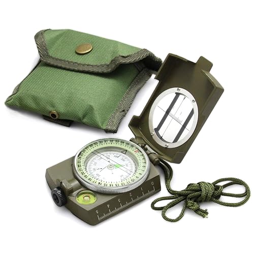
Eyeskey Multifunctional Tactical Survival Military Compass with Lanyard & Pouch
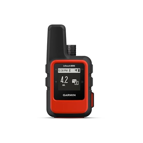
Garmin 010-01879-00 InReach Mini Satellite Communicator (Orange)
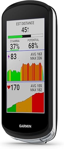
Garmin Edge 1040 GPS Bike Computer
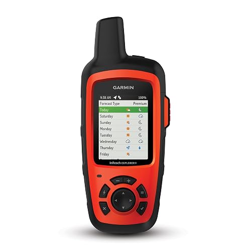
Garmin 010-01735-10 inReach Explorer+ Satellite Communicator

Garmin inReach Mini 2 Satellite Communicator (Orange)
LandAirSea 54 GPS Tracker (USA Made)
LandAirSea Overdrive GPS Tracker

LandAirSea Sync GPS Tracker (OBD-II)
Inside Each Recommended Option
The Eyeskey lensatic compass (a sighting-style compass that lets you read bearings through a built-in eyepiece) is the kind of tool that earns a permanent pocket in a pack. It runs on zero batteries, shrugs off rain, and keeps working long after a phone or satellite device has run flat. Hikers trained on map-and-compass navigation will appreciate the liquid-filled capsule, which damps needle wobble and steadies the reading in breezy conditions.
Unlike the Garmin communicators further down the list, this one does not transmit your position, but that is also its quiet strength. On a misty ridge, a needle does not lose signal. Pairing it with a paper topo (short for topographic) map turns the Eyeskey into a reliable failsafe when electronics fail, which is exactly the role a serious trekker wants it to play.
A Few Highlights
- Floating 360-degree dial with a liquid-filled capsule for stable, fast readings
- Optical eyepiece supports precise bearing work over long sightlines
- Level bubble and sighting reticle make triangulation more accurate
- Waterproof and impact-resistant body handles rough pack days
- Lanyard and pouch keep the unit accessible from a pack strap or hip belt
Things To Consider
- No digital features, so no breadcrumb trail or waypoint memory
- Lensatic compasses have a learning curve for readers used to phone apps
- Owners commonly report the sighting lens needs occasional cleaning to stay clear in dusty environments
Who It Suits Best
Backpackers who want a battery-free backup alongside a primary GPS device, plus scouts and instructors teaching foundational navigation skills.
Where Another Pick Suits Better
For two-way satellite messaging in true dead zones, the Garmin inReach Mini 2 (Item 5) is the smarter everyday carry.
The first-generation Garmin inReach Mini changed what lightweight backcountry communication could look like, and this orange unit still punches above its size. It tucks into a chest pouch or a hip-belt pocket, yet opens up two-way text messaging anywhere the Iridium satellite network reaches, which is most of the planet. The included Bluetooth pairing lets you compose messages on a phone instead of fumbling with a tiny on-device keyboard.
Solo travelers who log serious vertical gain tend to find this model fits the role of an emergency lifeline more than a navigation tool. A subscription is required to keep the satellite side active, which is the trade-off that catches some shoppers off guard. Compared with the Eyeskey compass above, this is full two-way communication, not just a silent bearing reader.
Useful Highlights
- Global Iridium coverage supports text messaging well past cell range
- Compact, rugged frame suits fast-and-light backpacking kits
- Triggerable SOS routes through a 24/7 emergency response center
- Bluetooth pairing with a phone speeds up longer message composition
Points To Note
- Requires an active satellite subscription to send or receive messages
- Screen is small for map viewing compared with the inReach Explorer+
- Charging port covers need a careful reseal to keep dust and grit out
Made For
Solo backpackers, thru-hikers, and adventure racers who want weight savings but still need emergency satellite contact.
Consider Something Else When
If on-device topographic maps matter as much as messages, the Garmin inReach Explorer+ (Item 4) is a better fit.
The Garmin Edge 1040 earns its slot here because the bikepacking crowd has folded GPS-enabled trekking into the same wish list as on-road riders. Multi-band GNSS (a satellite positioning technology that taps multiple frequency bands, including GPS, to improve accuracy under tree cover or in canyons) keeps the track log tighter when you ride under heavy canopy or through steep ravines, which is exactly where bikepackers lose reception. Long battery life means the unit can run an entire multi-day off-road tour without mid-route charging anxiety.
Where the inReach Mini focuses on emergency messaging, the Edge 1040 is built for the planning side. It catalogs course data, surfaces climbing segments, and tracks performance across days. Cyclists who mix paved centuries with gravel overnights will find that versatility compelling, even though it is heavier than a stripped-down head unit.
Reasons It Performs
- Multi-band GNSS improves accuracy in challenging terrain
- Long-lasting battery supports multi-day tours between charges
- Streamlined interface makes quick field setup easier on the bar
- Compatible with both on-road and off-road routing profiles
Honest Caveats
- Bulkier than a cycling-only head unit, which may bother weight weenies
- Best features require pairing with power meters or accessories many casual riders do not own
- Mapping depth matters more for cyclists than for trail hikers in this price tier
Best Suited To
Endurance cyclists and bikepackers who want one computer to handle paved centuries and remote dirt tours alike.
Look Elsewhere When
Pedestrian trekkers wanting handheld navigation will be happier with the Garmin inReach Explorer+ (Item 4).
The inReach Explorer+ blurs the line between satellite messenger and handheld GPS navigator by loading preloaded topographic maps onto the device. On a multi-week route through unfamiliar ridges, that combination matters. You can read a topo screen, drop waypoints, plan routes, and still send a text from the same handheld without juggling a second device.
The trade-off is size. Compared with the inReach Mini 2 (Item 5), the Explorer+ is bulkier in a hip-belt pocket. For a basecamp-heavy trip where weight lives in the pack rather than on the body, that is a fair swap. Anyone stepping off marked trails for the first time will find the on-device maps a confidence boost.
Useful Touches
- Preloaded topographic maps support offline route planning
- Two-way global text messaging via the Iridium network
- Built-in waypoint marking and route navigation
- Internal compass and barometric altimeter (an air-pressure sensor that estimates elevation) round out the navigation tools
Trade Offs
- Larger and heavier than the Mini and Mini 2 for ultralight kits
- Subscription fees apply for satellite messaging features
- Charging the unit between back-to-back trips requires a power source
Perfect Match For
Backcountry travelers who want map and messenger in a single handheld and carry a slightly larger pack to support it.
Not Your Match When
Fast-packers counting every gram should look at the Garmin inReach Mini 2 (Item 5) instead.
The Mini 2 refines the original inReach Mini in the ways that matter most on a long trail. TracBack routing is the headline upgrade. It traces your outbound path and points you back the way you came if weather rolls in or you overshoot a turnoff. That feature alone has saved a lot of late-afternoon scrambles into headlamp territory.
Two-way messaging and an interactive SOS are still the core, and Bluetooth pairing keeps the workflow familiar for phone-first trekkers. The unit is water resistant, which stands up to steady rain far better than splash-only ratings on some older devices. Pair it with a paper map and a compass like the Eyeskey in slot one, and you have a layered safety setup that handles most surprises.
What Works In Its Favor
- TracBack routing retraces your inbound path automatically
- Compact and lightweight enough for fastpacking kits
- Interactive SOS ties into a 24/7 response team for true emergencies
- Water-resistant build handles wet-weather routes confidently
Small Caveats
- Active satellite subscription required to send and receive messages
- Screen is still small for detailed map viewing
- Jurisdictional rules around satellite messengers vary, so check local regulations before relying on one abroad
Key Product Details
Who Should Grab It
Multi-day backpackers who want compact satellite safety with a smart return-to-start feature baked in.
A Better Fit Elsewhere
Vehicle owners wanting an always-on tracker should pivot to the LandAirSea 54 (Item 6).
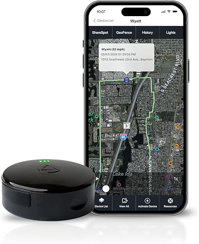
The LandAirSea 54 is less a trekking tool and more a logistics tool, which is why it sits on a list about trekking GPS gear with a wider scope. Its magnetic, waterproof shell sticks to a vehicle frame, an ATV rack, or a trailer crossbar, then reports position through a web dashboard or app. Real-time updates as fast as every three seconds and a year of playback history are useful for keeping tabs on overland rigs between trailheads.
A subscription is required to keep the data flowing, which is a real ongoing cost. The magnet is strong enough that owners commonly report a quick wipe-down before reattaching to keep the contact clean. For thru-hikers this is overkill, but for the driver who shuttles a vehicle to a remote trailhead, it fills a clear gap.
Positive Takeaways
- Strong magnetic mount for tool-free attachment to metal surfaces
- Waterproof housing handles rain, mud, and stream crossings
- Real-time tracking with playback history up to a year
- Geofencing alerts you when a vehicle enters or leaves a set zone
A Few Limitations
- Active subscription required to use tracking features
- Designed for asset tracking rather than handheld navigation
- Long-term owners recommend checking the magnet area for debris before reattaching
Feature Snapshot
Whose Shelf It Belongs On
Overlanders, trailhead-shuttle drivers, and anyone wanting an eye on a parked rig at a remote trailhead.
Swap It Out When
Backpackers who want a hand-held navigator should stick with the Garmin inReach Mini 2 (Item 5).
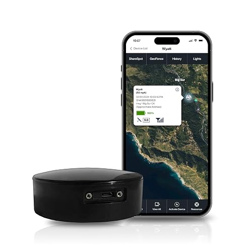
The Overdrive leans into the commercial side of the LandAirSea lineup with an extended-life battery built for trailers, equipment, and long-stored assets. International tracking in over 155 countries makes it appealing for cross-border trips, while the magnetic case keeps install time close to zero on metal surfaces. For a road-trip rig bouncing between trailheads in different states, the breadth of coverage is the appeal.
Like its siblings in this section, the Overdrive runs on a subscription model. Charging habits matter more than with the smaller 54, and storage in a hot cab is worth a second thought. Compared with the compact Sync in the next slot, this is the one for equipment that does not plug into a 12-volt port.
Where It Helps
- Extended-life battery reduces charging frequency on long deployments
- Magnetic and waterproof case handles rough commercial environments
- Real-time global tracking across 155+ countries
- Geofencing and movement alerts suit fleet-style oversight
Where It Is Less Suited
- Subscription required to keep the tracking active
- Bulkier than the plug-in Sync tracker for passenger vehicles
- Best returns come with consistent recharging routines, which casual users may forget
Quick Facts
Built With In Mind
Small fleet operators, overlanders, and trailer owners who need long intervals between charges and broad geographic reach.
Reach For A Different Pick When
Daily drivers wanting a set-and-forget tracker should consider the LandAirSea Sync (Item 8) instead.
The Sync closes the list by going in the opposite direction from the rugged handheld devices. It plugs directly into a vehicle’s OBD-II port, the standardized diagnostic connector found in most cars and light trucks built after 1996, drawing continuous power and reporting position through 4G LTE. There is no battery to charge and no magnet to position. For a daily driver that shuttles gear to the trailhead, that simplicity is the whole point.
Real-time updates as fast as every three seconds and a year of playback history mirror the 54 and Overdrive. The catch is the OBD-II form factor, which means it is not for trailers or older vehicles without that port. Compared with the Overdrive above, the Sync is the cleanest fit for a single car or van you actually drive every day.
Where It Delivers
- Plug-and-play install into a standard OBD-II port
- Continuous vehicle power means no recharging routine
- Real-time tracking with up to a year of playback
- Compact size keeps the unit out of sight in a cabin
Practical Considerations
- Requires an active subscription to function
- Not compatible with vehicles lacking an OBD-II port
- Sharing a vehicle means the tracker is always present, which may not suit every household
Core Details
The Right Fit
Daily drivers and small fleets who want set-and-forget tracking powered by the vehicle itself.
Another Choice May Suit
Overlanders moving between trailers and unpowered equipment will prefer the LandAirSea Overdrive (Item 7).
Matching Trekking Gps To The Way You Actually Travel
Start with the terrain and the trip length, not the spec sheet. Day hikers in familiar woods often need far less than a week-long alpine traverse. A handheld that combines topographic maps with satellite messaging, like the inReach Explorer+, pays for itself in remote areas where a wrong turn can compound into a real problem. A lensatic compass still belongs in a kit, since electronics can fail in cold, wet, or low-battery moments.
Subscription costs deserve a hard look. Satellite communicators and the LandAirSea trackers all run on paid plans, and a device you do not activate is just dead weight in the pack. Match the plan to the trip cadence, since month-to-month and annual options suit different use patterns. Battery life matters more than screen brightness on multi-day routes, especially when temperatures drop.
Weight is the next filter. A thru-hiker counting grams will shrug off a 100-gram device, while a basecamp tripper will not notice. Cyclists sit in a third category, where bar real estate and battery life matter more than the absolute number on a scale. The right trekking GPS is the one you will actually carry, charge, and learn before the trip starts, not the one with the longest feature list on paper.
What To Weigh Before You Pick
Common Shopping Slip Ups
A frequent mistake is buying a satellite communicator without checking the subscription model. Some plans lock you into annual contracts, while others pause cleanly between trips. Equally common is picking a handheld without confirming it accepts the maps you actually use, since some units rely on proprietary downloads that cost extra. Ignoring battery behavior in cold weather is another trap, as lithium cells lose usable runtime once temperatures dip near freezing.
What The Higher Tier Buys
Spending more usually means a sharper screen, a longer-lasting battery, and richer onboard maps. Higher-tier handhelds also tend to support more GNSS bands, which translates to better accuracy under tree cover or in steep terrain. The Garmin Edge 1040 is a good example: the upgrade from a basic cycling head unit to a multi-band computer costs more but solves the canopy problem that frustrates so many riders. For most weekend trekkers, the sweet spot is mid-tier, where the map detail and battery life meet the budget without a step up to professional mapping ecosystems.
Frequently Asked Questions
What is a trekking GPS used for?
A trekking GPS helps you navigate, mark waypoints, and track your route in areas where a paper map alone feels risky. Satellite communicators add two-way messaging and SOS for emergencies.
Do handheld GPS units work without cell service?
Yes, most trekking GPS units receive satellite signals directly and do not need a cell network to log position. Satellite communicators use a separate satellite network for messaging, which is why a subscription matters.
Is a compass still worth carrying with a GPS device?
A lensatic compass is a smart backup because it does not rely on batteries or satellite reception. Many experienced trekkers keep one in the kit as a redundancy layer.
How long do GPS batteries typically last?
Battery life varies widely by model, ranging from a few days on a basic handheld to several weeks on a tracker in low-reporting mode. Cold weather, screen brightness, and tracking frequency all drain cells faster.
Are subscription-based trackers a good fit for casual users?
Casual users may want a month-to-month plan rather than an annual contract, so the cost stays proportional to actual use. Weigh the recurring cost against how often you need live tracking.
Closing Remarks
The right trekking GPS depends less on the spec sheet and more on the kind of trips you take. A backcountry hiker, a long-distance cyclist, and a shuttle driver all need different tools, and this list reflects that range. Pick the option that matches the way you actually travel, learn its core functions before the trip, and the gear will do its job when the trail gets interesting.